


Les Pérics

xav34830
User
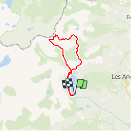

Length
21 km

Max alt
2794 m

Uphill gradient
1077 m
Km-Effort
35 km

Min alt
2002 m

Downhill gradient
1075 m
Boucle
Yes
Creation date :
2014-12-10 00:00:00.0
Updated on :
2014-12-10 00:00:00.0
--
Difficulty : Medium

FREE GPS app for hiking
 SityTrail
IGN / Geographical institutes
SityTrail Plus
The world is yours!
About
Trail Walking of 21 km to be discovered at Occitania, Pyrénées-Orientales, Les Angles. This trail is proposed by xav34830.
Positioning
Country:
France
Region :
Occitania
Department/Province :
Pyrénées-Orientales
Municipality :
Les Angles
Location:
Unknown
Start:(Dec)
Start:(UTM)
418194 ; 4712354 (31T) N.
Comments
difficile
un parcours en boucle intéressant pour accéder aux 2 sommets. le passage en crête est escarpé, aérien et demande un pied sûr.